

GOCE satellite: Maldives 100 meters below
Being a Maldivian, the thing that jumps out the most on the just recently released gravity model produced from the high resolution measurements of gravitational pull across the Earth, gathered by the European Space Agency's GOCE satellite, is that Maldives is located within a curious blob of colour - the only blob of that colour in the map. The colour blob, it turns out, signifies areas where the difference between the geoid (a hypothetical global mean sea level undisturbed by weather and currents) and the perfect ellipsoid shape that Earth approximates overall, sinks to its lowest of -100m!
Apart from that, this reaffirms that the gravitational pull experienced in the Maldives is lower than most places on Earth...
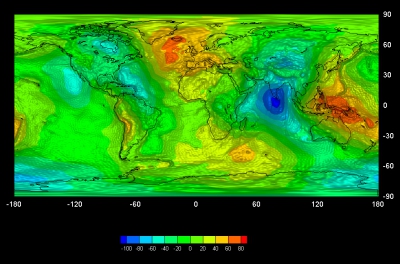
Credits: GOCE High Level Processing Facility
Apart from that, this reaffirms that the gravitational pull experienced in the Maldives is lower than most places on Earth...
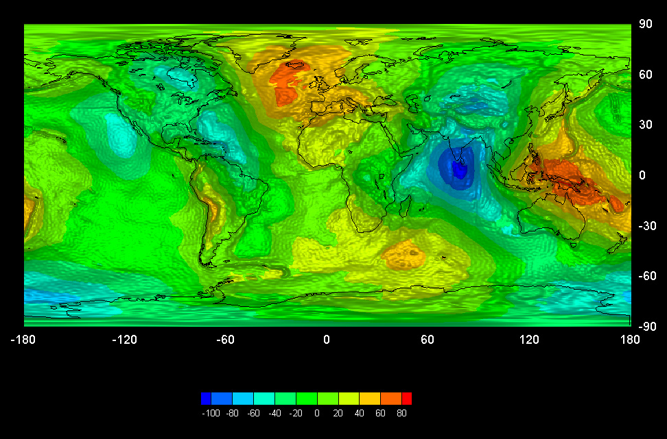
Credits: GOCE High Level Processing Facility


